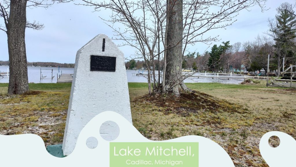
Join DaViking (my husband, Chuck) and I as we search for the 33 markers commemorating an ancient trail from Cadillac to Traverse City, The Old Indian Trail. Evidence found along the 55 mile trek has been dated to 700 B.C.E. This passage had been used by the Hopewells and then in the 1200’s the Anishinaabe tribes of Michigan walked these routes. These tribes are known as “The Three Fires:” Ojibwe, Odawa and Pottawatomi tribes.
Fresh water clams had been a valuable resource for natives. They used fresh water pearls for trading as well as clams a food source.
With many relatives living in the Traverse City area, I have traveled north oodles of times. I hadn’t realized that this history had been set out for us by several individuals over the past decades. These historians had worked hard to research this data and lay out a path for us so we could always remember!
Milo Petoskey Crosby and Jim Pontiac
In the late 1800’s Milo Petoskey Crosby had heard about the Old Indian Trails when he arrived in Wexford County. Crosby spent time hiking the area and learning about the past. When he retired in the1940’s Milo Petoskey Crosby along with Jim Pontiac had placed the first fourteen markers.
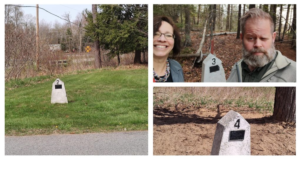
Three sits near the village of Boon and is labeled “Boon Marker.”
Four is called “The Sweet Spot Marker.”
Marker three holds the history of fields where crops of beans, corn and squash had been grown for the village of Boon.
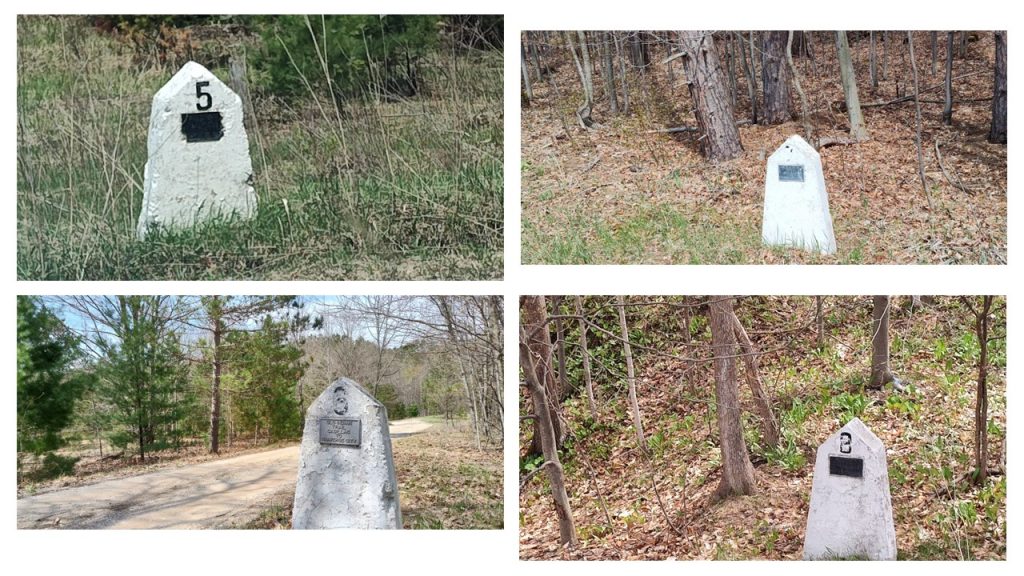
Six had been designated as the “Old Ash Marker” since it had once been a forest of ash trees.
Seven was named the “Circle Marker.”
Eight had been titled, “Farm Marker.”
Ash trees had been a vital resource for native tribes. They had used ash trees to make bows and other tools.
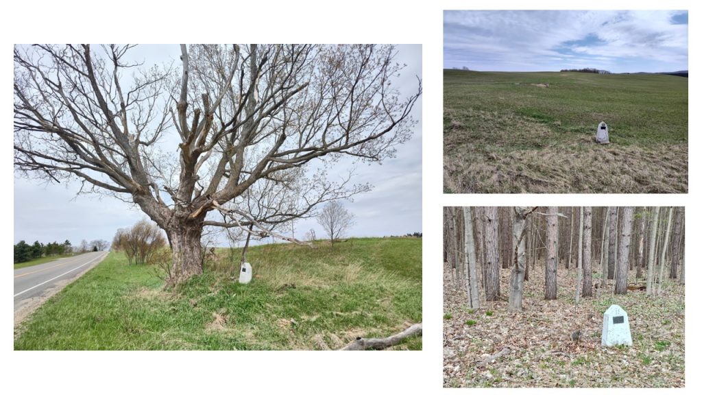
Ten (top right) was known as “Gentle Grade Marker.”
Eleven was called, “Restful Marker.”
Meauwataka means “halfway” in Pottawatomi, marking the mid point between Clam Lake and an Indian Village. People would camp for the night near marker nine.
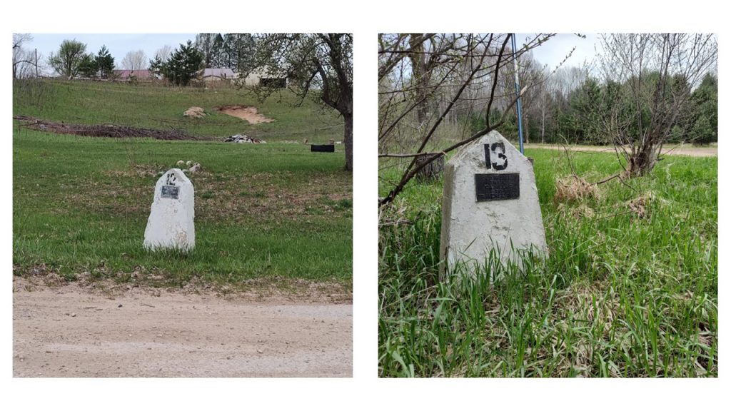
Marker 13 is called the “freight trail.”
Markers twelve and thirteen sit on roads that run parallel to one another. Heavy freight would often cause rutted roadways. Therefore, stagecoaches ran on separate pathways to give their riders a smoother journey.
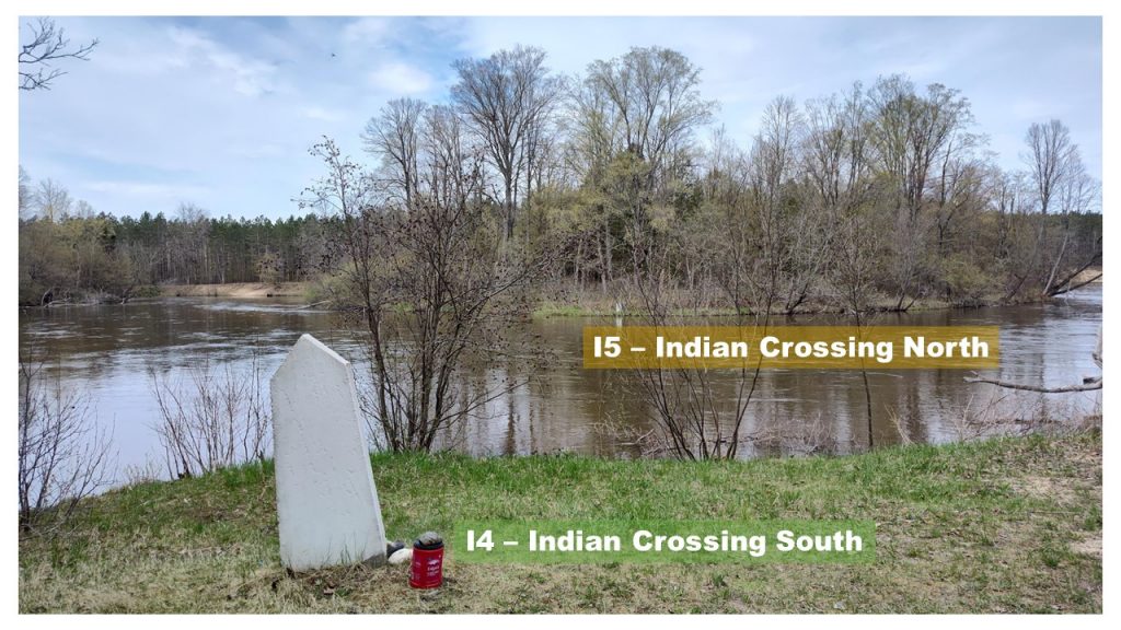
Years later, logging companies had wanted to float their newly harvested lumber down this river. It reportedly took 700 pounds of dynamite to break apart this natural dam.
The Boy Scouts
A Boy Scout troop had replaced markers #14 and #15 on a calm September day. They had waded across to the other side of the river and placed Marker #15.
Edward Babcock and James Comp
Edward Babcock, a high school teacher, and James Comp, a Cadillac historian, continued Crosby’s research. Together they set the next five markers.
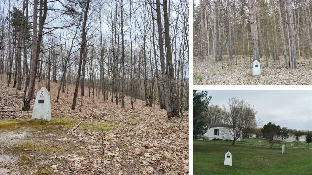
This shows that the area had been an extensive campground.
Marker seventeen is referred to as the “Buckley South Marker.”
Marker eighteen is called the “Buckley Center Marker.”
Marker nineteen (pictured below) is named “Buckley North Marker.”
During this time, Edward Babcock had spent his summers working at Camp Torenta. Edward Babcock had talked about his project of labeling the Old Indian Trail. This had left an imprint of interest in one particular camper, Chuck Bidleman. (Remember his name for later.)
Frank Ettawagheshik
Frank Ettawagheshik, the former Chairman of the Little Traverse Bay Band of Odawa Indians, led a sesquicentennial group who researched, planned and conducted fundraising for seven years. Finally, in 1987 the final markers were placed numbered twenty through thirty-three.
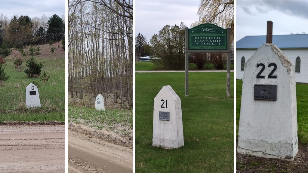
Twenty-one holds the label, “Mayfield Marker.”
Sitting next to St. Mary’s Church, Marker twenty-two is entitled, “Saint Mary Marker.”
Black ash trees had been significant. ( Marker 20) When slices of the tree were pounded, the rings would separate, creating strips. These thin pieces could be soaked and woven into baskets. This resource had been vital to the native tribes.
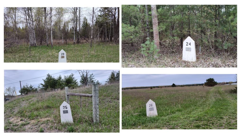
Twenty-four is named “Deer Marker.”
Twenty-five holds the label of “Vance Road Marker.”
Twenty-six is “Chums Corner Marker.”
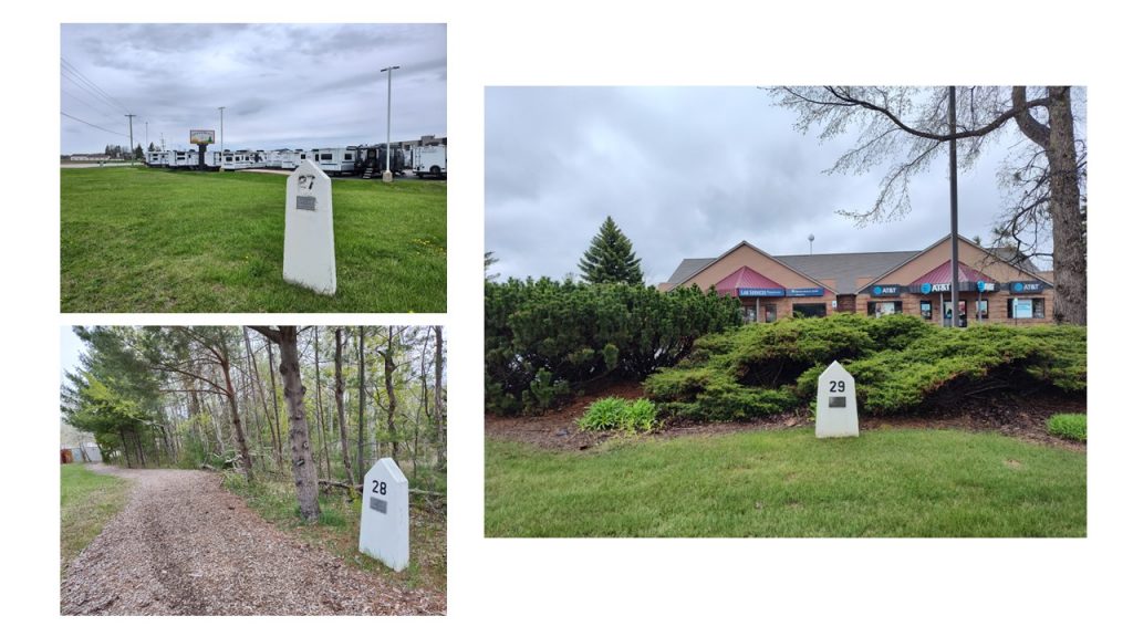
Twenty-eight is referred to as the “Wemeck’s Marker.”
Twenty-nine is called, “South Airport Marker.”
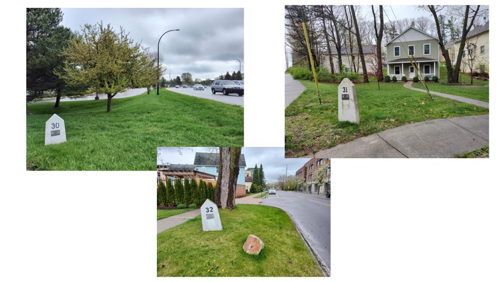
Thirty-one is called “Cass Street Marker.”
Thirty-two is entitled, “Boardman River Marker.”
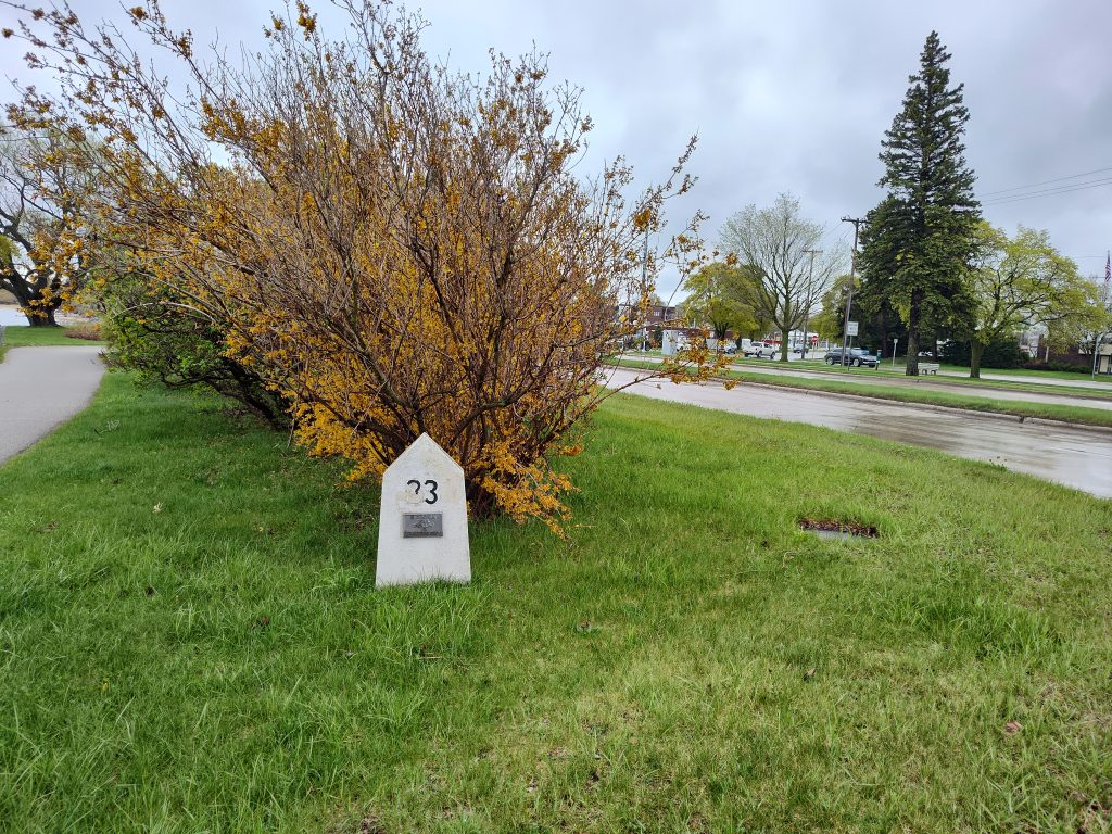
At the Boardman River marker, travelers would turn west and follow the edge of the flowing water until one passes by the mouth of the river emptying into Traverse Bay. Continuing west until one would find Marker # 33. The last marker along this trail brings an adventurer to the water’s edge where a canoe could be utilized.
Woody Unruh

Photo Credit: Woody Unruh Twitter/Facebook
Woody Unruh from Lake Ann’s Boy Scout Troop 105 had been noted for refurbishing the thirty-three markers in 2013. As you could see after a decade of being exposed to the elements most markers have remained in decent shape. Nice job, Woody! Thank you!
Chuck Bidleman
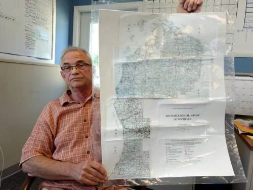
In 2017, Chuck Bidleman, a 71 year old retired teacher, was interviewed by the Cadillac News. As a youngster, Chuck had originally learned about The Old Indian Trail from a Camp Torenta counselor, Edward Babcock. (Do you remember him? Edward had placed five of the markers.) Chuck continued to research these treks which run throughout our state of Michigan. To keep history alive, Bidleman had contacted school groups, a country club and then senior citizens to conduct investigative reporting and show where this path had once been.
which he’d pieced together from county records dated 1931.
Photo Credit: Cadillac News
“This survey sits in every register of deeds office in every county of the state,” Bidleman said. “This is a free history book.” Chuck Bidleman had been curious about this trail since his childhood and had spent hours locating the exact placement of the trails. In the late 1830’s as the surveyors had marked each square mile with six section lines, they had noted the native trails on their maps.
Jennifer Brown
Jennifer Brown, Superintendent of Cadillac Public Schools, had been teaching 8th grade in 2004 when Chuck Bidleman had contacted her about researching a connection between The Indian Trails and The Underground Railroad. By May 2005 the students proposed that these trails had also been pathways for escaped slaves who hoped to reach Canada.
Andy Ulrich
Chuck Bidleman had approached Andy Ulrich, the clubhouse director for Club Cadillac, with information that The Old Indian Trail had passed right through the property. Measurements were made and sure enough, it had!
Ulrich had commented, “Chuck came to us and said he thought there was an old native trail near our property. Our building was once a one-room school and a lot of the old schools are on these old trail.”
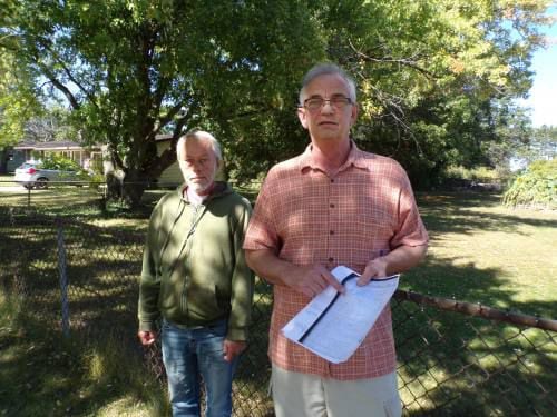
Photo Credit: Cadillac News
Michigan’s Native Trail Network
In another resource by Thumbwind, it was believed that many of Michigan’s Indian trails had originally been created by migrating bison herds. LaSalle, the French explorer, had noted bison herds’ movements in his journals.
There has been a network of trails throughout Michigan with Saginaw being a “hub” for indigenous people. One hundred nine Chippewa Indian villages have been documented in the Saginaw Bay area.
Emily Modrall – The Future
Emily Modrall, an archaeologist who is originally from Suttons Bay (near Traverse City), is planning on extending the marking of the trail system westerly to Lake Michigan. In the January 2022 she had been interviewed by
9 & 10 News. Emily Modrall had said, “I saw an opportunity to try to help make that history more visible and acknowledged and understood through some new signs,” Modrall had explained. “Our Anishinaabe neighbors and the Grand Traverse Band community, these are their families that have lived here for centuries.”
I stand in awe of the amount of people who have dedicated their interest, time and funds to helping to preserve our indigenous history. This has struck chords in my soul. There is so much in this world to appreciate and to learn about. Stay alert and enjoy!
Related Links:
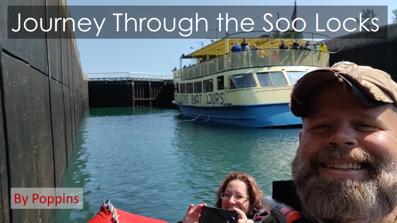
Here’s the YouTube video of our caper along the 55 mile Old Indian Trail.
Resources:
Cadillac News Article by Mardi Suhs “Retired Teacher Enlists Others Help On History Project”
September 26, 2017
Map of Cadillac to Traverse City on Google
9 & 10 News story
Thumbwind article
Record Eagle article
To learn more about the old Indian trail, visit oldindiantrail.weebly.com.


