Have you ever spray painted graffiti? I never imagined I would, but near Amarillo, Texas there are ten Cadillacs buried, fin-up for anyone to leave their mark. This was just one of our stops along Route 66.

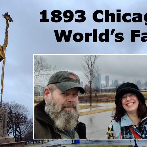
As we drove on the highway from Chicago to Arizona we followed alongside old Route 66, “America’s Glory Road.” This roadway housed attractions and hotels along the 2,400 mile route. It spanned all the way from Chicago to Los Angeles.
I followed our path in a travel book, “The EZ66 Guide” from my friend, Kim. She’d traveled this route with her friend a few years ago and shared this helpful resource. (Kim had circled some of her favorite spots!) The guidebook reminded me of the ‘AAA trip tics’ we used on family trips in the 1970’s. I could keep my finger on our location using the maps. (I like that!) “The EZ66 Guide” was chocked full of interesting facts and locations for each of the eight states. We stopped at several. Stay tuned for snippets of our adventures in upcoming articles!

Traveling makes a Viking hungry!

In the span of a single generation, Route 66 went from being a booming roadway with economic promise to a collection of dilapidated towns all along the way. Sadly, now many businesses along Route 66 are in ruins. We were determined to soak up the remaining sights as we crossed our beautifully diverse country.

How did this roadway come to be? What happened to these towns in such a short span of time? I wondered aloud to Da Viking. “It sounds like an article to me!” he smiled.
The Beginning of Route 66
Cyrus Avery of Tulsa, Oklahoma, and John Woodruff of Springfield, Missouri were visionaries. Around 1914 they began to lobby congress about creating a single roadway from Chicago to Los Angeles.
Lieutenant Colonel Dwight D. Eisenhower led a convoy on a road trip across our nation. Nearly 300 people and 80 vehicles left Washington D.C. in July of 1919. They arrived in San Francisco, California on September 6th, 1919. They had traveled for 62 days and covered 3,251 miles. This set a long distance record. The photos below helped shape the desire for a transcontinental roadway.

Photo Credit: American Historian
The dirt roadways were dusty and rough on the slender-tired automobiles. Flat tires were a daily issue. After a rainstorm the mud caused these narrow tires to sink.

Photo Credit: American Historian
Weak bridges weren’t reliable for loaded trucks to pass. Sixteen bridges collapsed in one day along the route. They needed to be repaired before their return trip.

Photo Credit: American Historian

Photo Credit: American Historian
With these photos Dwight D. Eisenhower and the Motor Transport Corps convinced congress to enacted a national campaign to build a connective artery of commerce through our country. The Townsend Highway Bill, established a Federal Highway Commission. This group could appropriate money for the construction of roads under the guidance of congress. “Route 66” was named in 1926. With it’s diagonal path connecting communities, farmers had an easier time hauling their crops and livestock. With secure bridges in place by the 1930’s trucking was rivaling the train industry.
As the Dust Bowl and Depression knocked our nation to its knees, around 210,000 people moved west to California on the “road of opportunity” Route 66. Many others were put to work paving this pathway. The laying of asphalt was completed by 1938.
As World War II loomed, the thoroughfare provided troop transportation. Battalions trained in the dry, consistent climate of the southwest.
In the fall of 1945 troops were returning to the states and ready for some relaxation. Many chose to abandon snowy climates and relocate along Route 66. This was known as ‘the barbecue culture.’ Families traveled Route 66 as their vacation destination.

San Bernardino, CA
First, there were “auto camps” at specific locations along Route 66. Families could rope off sections around their cars and camp. State employees would provide water, showers, toilets and laundry facilities free of charge. Next, “Cabin Camps” popped up, sometimes called ‘cottages.’ These stops developed into rest areas and motels.
Businesses were growing like dandelions along the side of the roadway. Filling Stations, diners, motels and giant tourist attractions with souvenir shops supplied the thousands of people who traversed this line daily.
“Get Your Kicks On Route 66” was written by Bobby Troup, a famous pianist with Tommy Dorsey. Nat King Cole recorded this song in 1946, one week after Troup arrived in California.
Foreshadowing the End of Route 66
Dwight D. Eisenhower, a man who loved to make improvements in our roadways, returned from Germany and reported about Hitler’s Autobahn. “I saw the superlative system of the German national highways crossing that country and offering the possibility, often lacking in the United States, to drive with speed and safety at the same time.”

The Federal Aid Highway Act of 1956 provided funding for a national interstate and defense highway system. These federally subsidized programs aimed to construct a more fluid, consistent system of thoroughfares throughout our country.

“Route 66” a TV show ran for four seasons.
Photo Courtesy of The Boston Globe
Every Friday from 1960-1964 the television show, “Route 66” would entertain our nation. Martin Milner and George Maharis brought people along on their journey down the “Mother Road.” I had no idea there had been this weekly array. I watched the beginning of an episode on YouTube. (See “Resources” below for the link) The men were looking for a shortcut as a bridge wasn’t functional. This was a correct representation of the roadway due to the increasing weight of trucks traversing the Route 66.
Expressways bypass Route 66
By 1970, most of Route 66 had been re-routed with four lane divided highways. These new expressways bypassed the small towns and businesses that had once flourished. Many tried to re-invent their businesses to attract travelers, but most fell into disrepair and were abandoned. In 1984 the last section of Route 66 was bypassed in Williams, Arizona.


Looking Forward
Route 66 provided the largest boom the United States economy had ever seen. Following World War II Route 66 provided travelers with unique sites and many utilized the trek to migrate out west . It served our nation well. The National Historic Route 66 Federation is a strong organization and working hard to preserve this American History. (See their link under ‘Resources.’)
There are still many sites to visit and enjoy along Route 66! Look for future articles highlighting several stops we made along our journey!

Stroud, Oklahoma


Resources:
“The EZ66 Guide for Travelers” 4th Edition by Jerry McClanahan 2015
https://americancarhistorian.com/1919-transcontinental-army-motor-convoy/
National Historic Route 66 Federation
https://www.youtube.com/watch?v=3rrhdye3wmE


