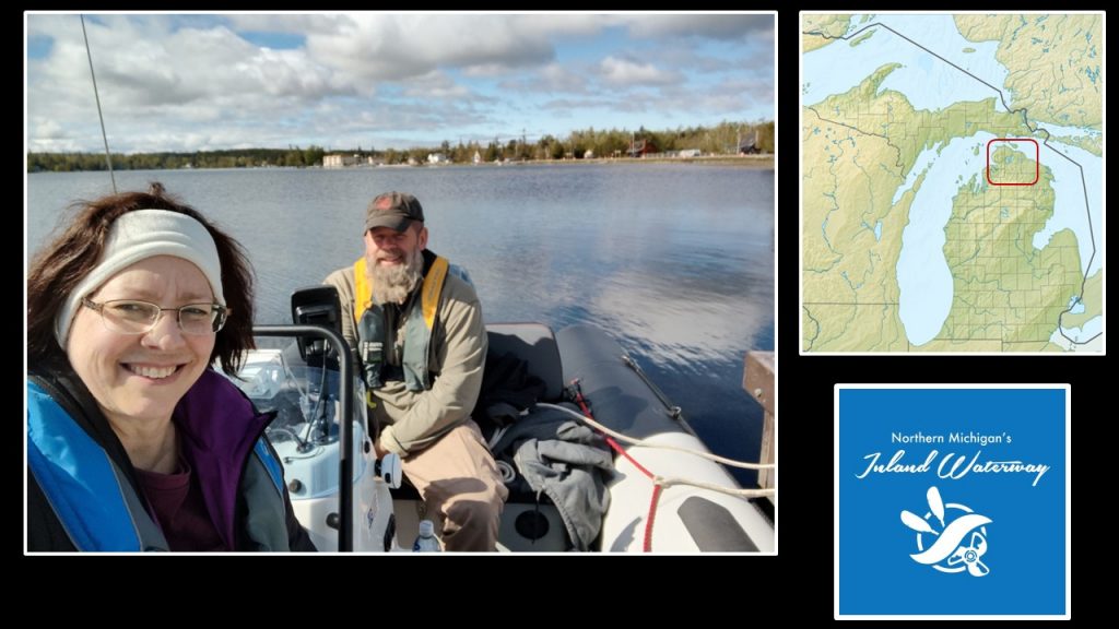
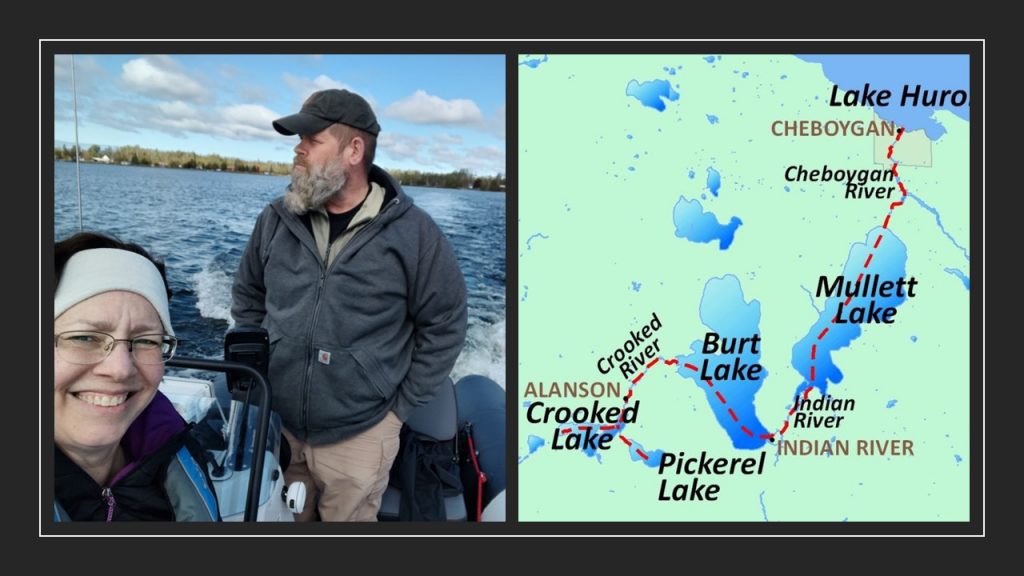
What? There’s an inland waterway in Michigan? Honestly, I hadn’t known about this treasure until a few years ago when Chuck and our son, Noah, ventured through the three lakes and three rivers. Since their trip, I’ve been curious about this water path. I was giddy on this mid-May day, when I would finally get to travel this 3,000 year old passage. Join us on our journey!
25,000 years ago, when the glaciers retreated, they left our fresh water lakes. Burt Lake and Mullett Lake, along this route, are Michigan’s largest inland bodies of water.
Anishinaabe
The Anishinaabe had used this passage for centuries. Even with some portages, carrying their canoes and supplies, this route had been a shorter distance and less treacherous than following the Lake Michigan shoreline around Waugoshance Point. (marked with yellow dots above)
Remnants of fifty Anishinaabe encampments have been located along the shorelines by Michigan State University archeology groups. At the Ponshewaing site some artifacts have been dated at 3,000 years old, proving this pathway has been a life line well before written history.
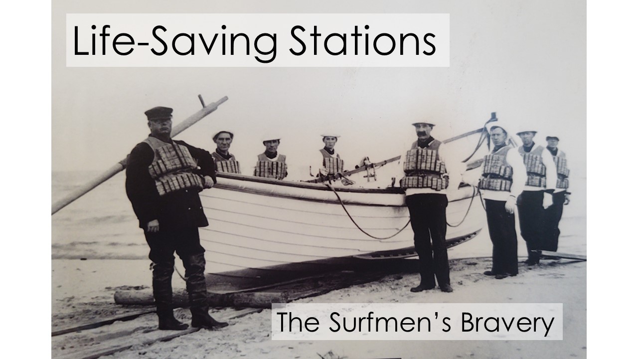
Lumber Camps – Mail Delivery
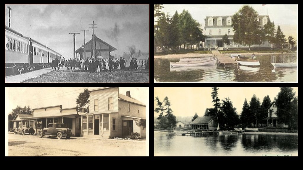
When Europeans arrived, they utilized the area’s natural resources. In 1874 the Grand Rapids & Indiana Railroad had reached Petosky. With three trains weekly, the line carried lumbermen northward. Lumber camps throughout the area had been bustling year round.
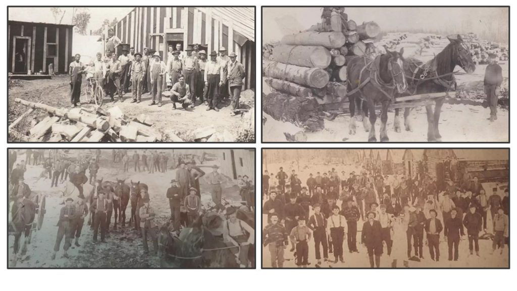
Photo Credit: WITL Lansing
With so many lonely lumbermen living in the camps, Frank Sammons, a local from Cheboygan, saw the potential for using the inland waterway to carry mail as well as supplies. Letters could boost the men’s spirits.
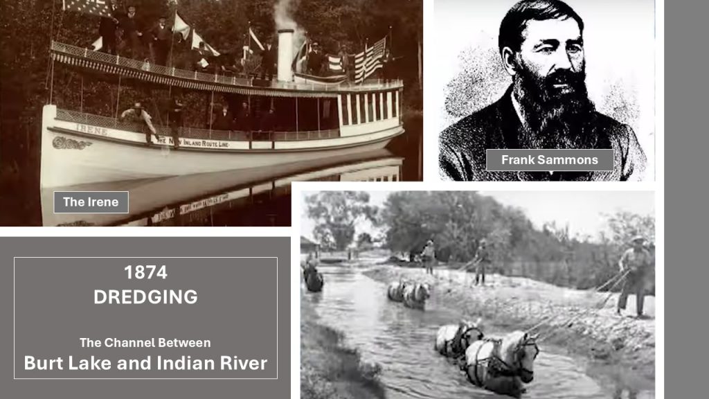
(bottom right) This is how dredging with horses had been done.
In 1874 Sammons hired two white men and two native men to begin dredging where Indian River meets Burt Lake. Using horses they accomplished this task so the Maude Sammons, Frank Sammons’ vessel, could deliver supplies and mail.
From 1876-1920 nearly one hundred different watercraft had been coursing the inland waterway moving goods and people.
The railway and steamship companies had turned their focus to tourism.
Tourism
Seeing the potential for tourism, the “Mackinac Island Hotel Company” was formed. This partnership consisted of the Cleveland Steamship Navigation Co. along with two railroads: Grand Rapids & Indiana Railroad and the Detroit Railroad. Together they built the Grand Hotel on Mackinac Island which opened in 1887.
The Grand Rapids & Indiana Railroad north, known as “The Fishing Line,” carried fishermen and tourists northward.
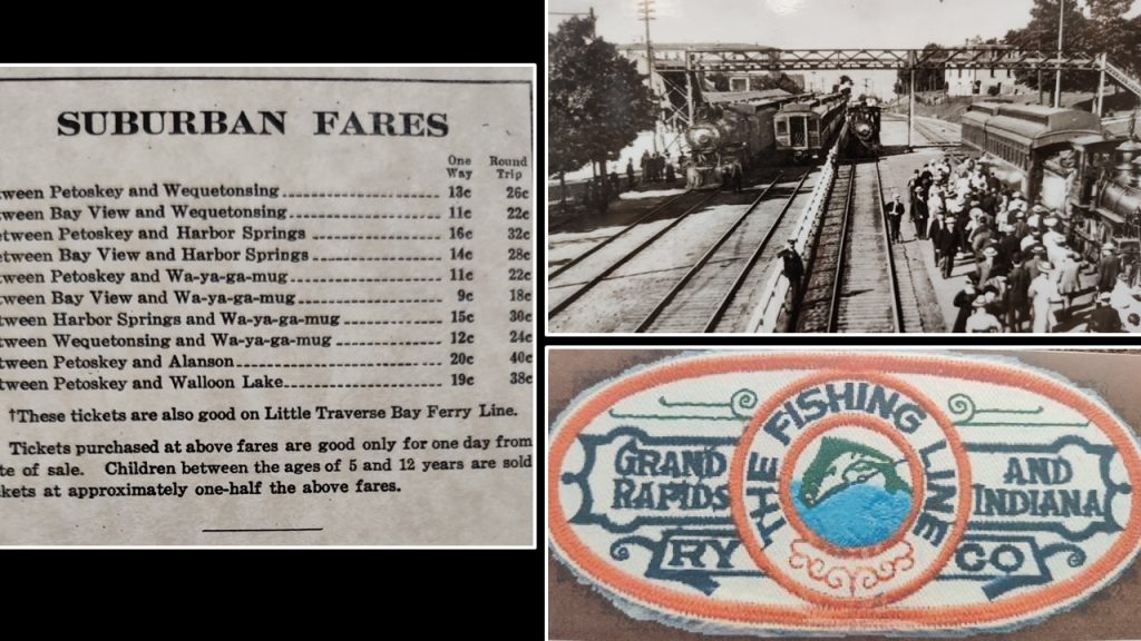
These tourists would board a series of steamships through the Inland Waterway, spending the night at one of the hotels along the route.
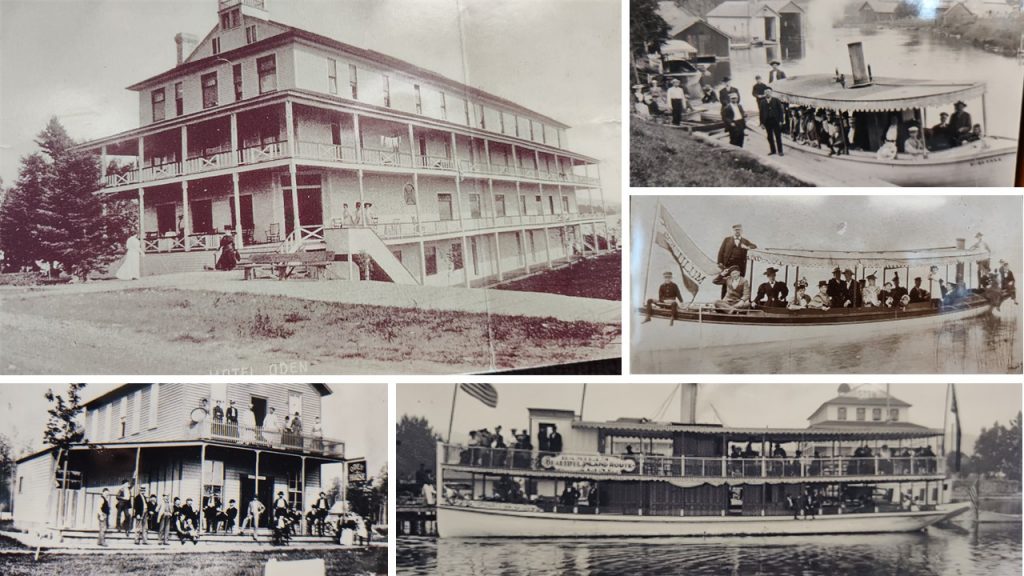
A typical itinerary would be to take the Irene from Oden to Topinabee. Then transfer to the Wilson and travel to Cheyboygan. Finally, travelers would transfer to the Sailor Boy heading for St. Ignance in the upper peninsula.
Charles R. Smith had formed the “Inland Navigation Co” and had three boats running between St. Ignace and Mackinac Island: ‘The Northern Belle,’ the ‘City of Cheboygan’ and ‘Propeller Mary.’
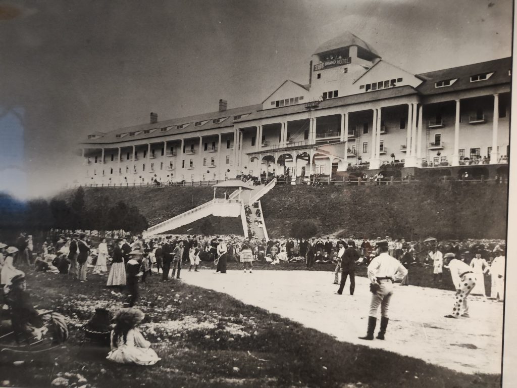
As you already know, the Grand Hotel is still a destination today after 138 years!
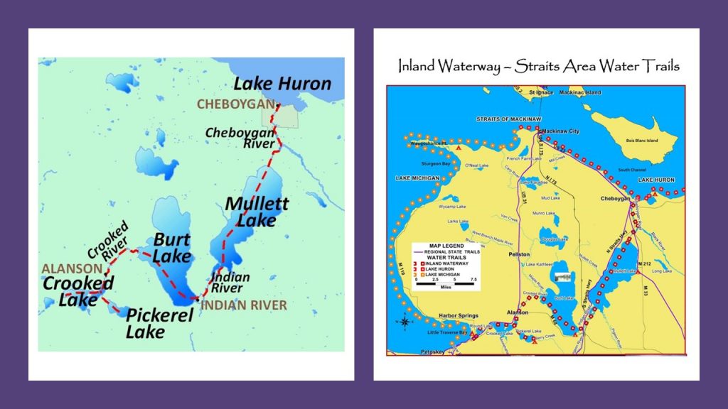
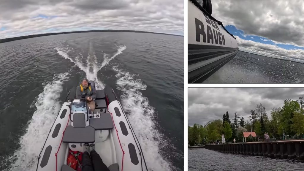
Crooked Lake – Our Launch Site
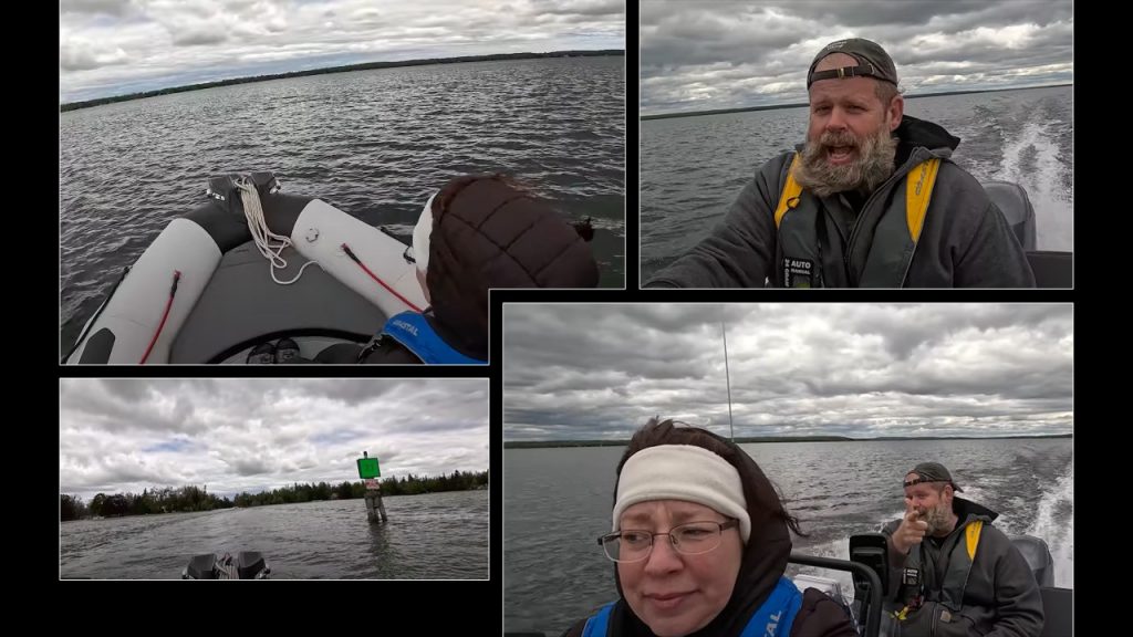
Dressed in snow pants and a down coat, I was prepared for this Spring adventure! The locks had just opened, so we would be able to travel the whole 38.2 mile course. That’s right. There are two actual locks and a swing bridge on this journey.
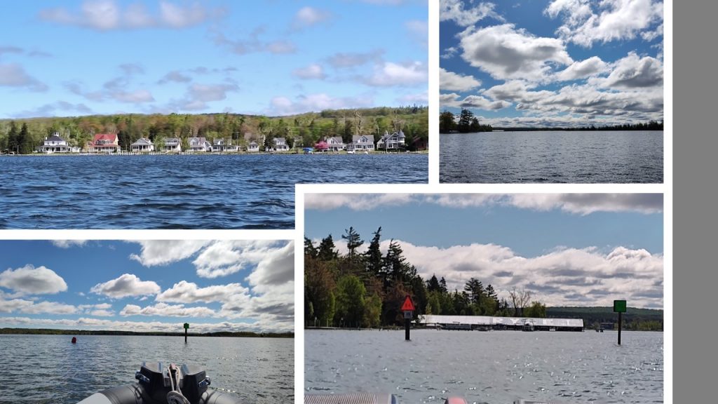
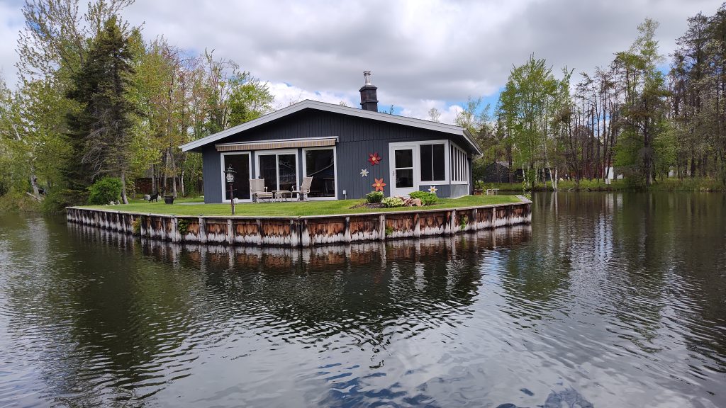
We launched Sea Raven at Conway, Michigan’s public dock on Crooked Lake. Beautiful cottages lined the shoreline.
Conway – Oden Settlements
The GR & I railroad would drop passengers off between Conway and Oden. Overnight lodging would be available at several locations, plus entertainment. Oden had a casino, a dance hall, a roller rink and two bowling alleys.
Today, Oden hosts guests at their fish hatchery which has been a tourist destination since 1921. Both towns are quaint and touristy.
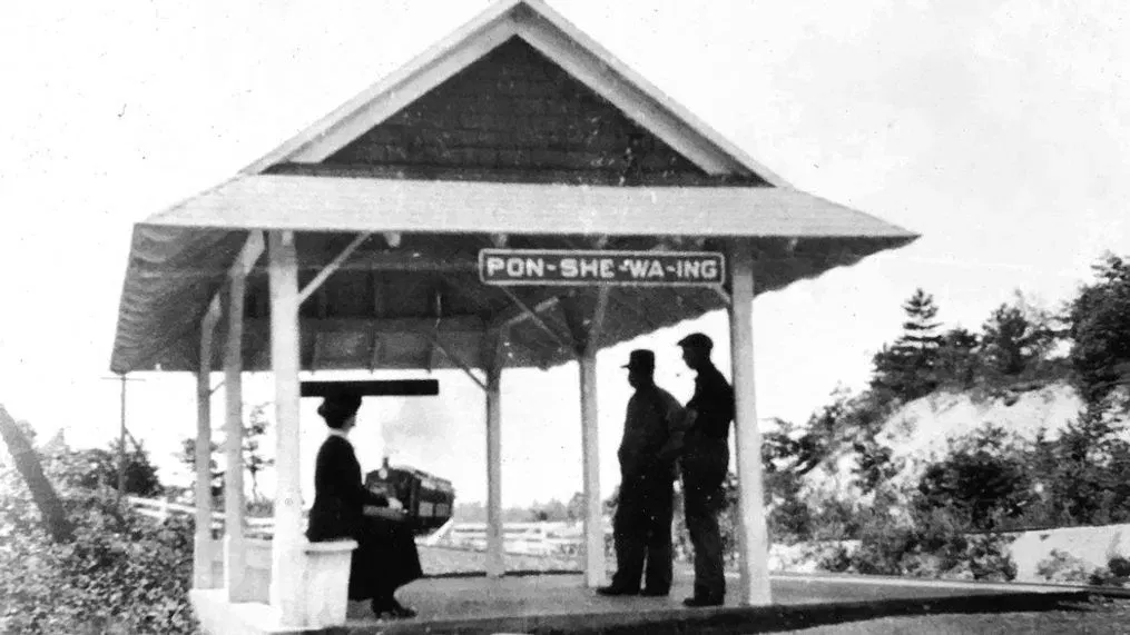
Ponshewaing
Along the northern shoreline of Crooked Lake is the 3,000 year old settlement, Ponshewaing, meaning “winter home.” This is where Michigan State University has found artifacts sleeping in the soil. These pieces have given us a peek into the past.
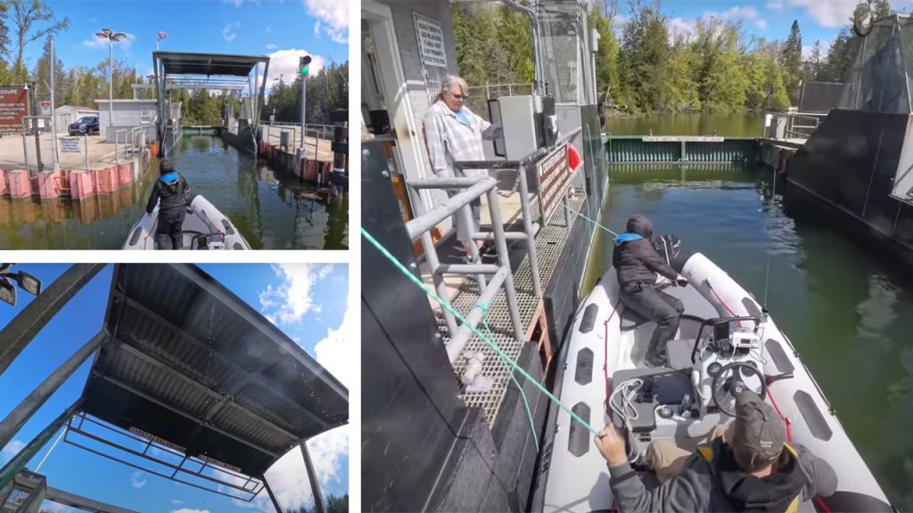
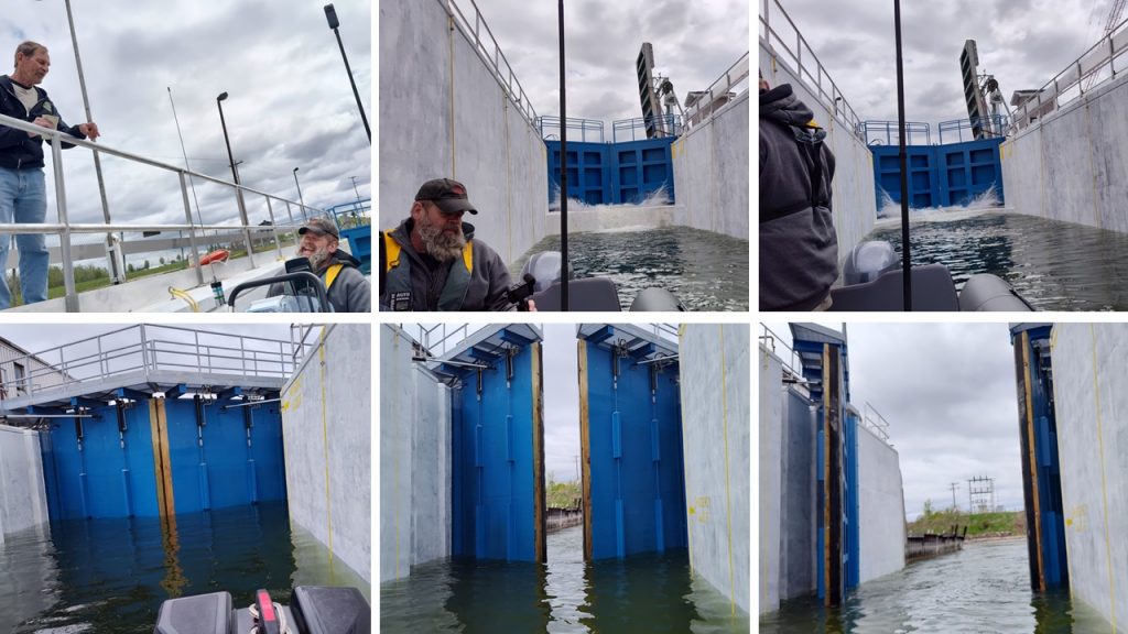
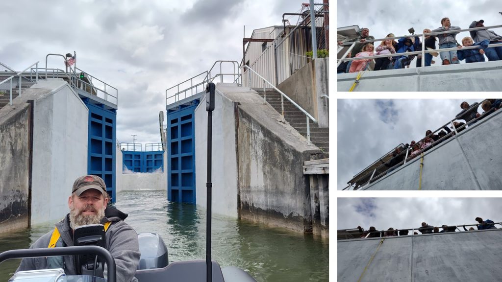
As we rounded the bend, The Clam Shell Lock came into view.
Crooked River – Gravity Powered Lock
Get your cash ready. Payment is due at time of service. The lock supervisor came to the edge to collect our fifteen dollar fee. “When are you comin’ back through?” She asked.
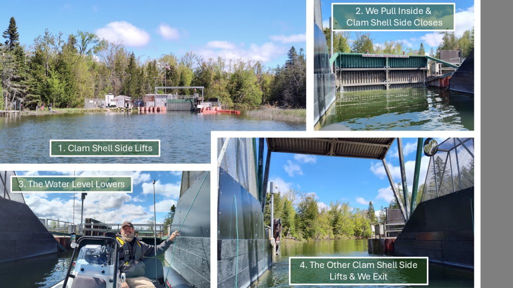
This uniquely designed, gravity-powered lock has been working since the mid 1950’s.
This ‘clam shell’ lock had been constructed by the U.S. Army Corps of Engineers.
“We’re not. We’re going straight through.” Chuck answered as I held tightly to the line with one hand and the camera with the other. In just moments the water level lowered less than a foot and we were on our way.
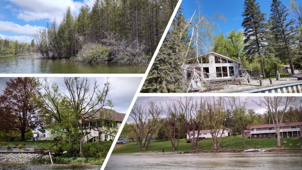
We bubbled along the Crooked River. Many cottage owners were cleaning up branches which had fallen during the ice storm a few months ago.
Alanson Swing Bridge
The Alanson Swing Bridge, on the Crooked River, is the world’s smallest operating swing bridge. The bridge had to be swung open for Noah and Chuck a few years ago. (top right)
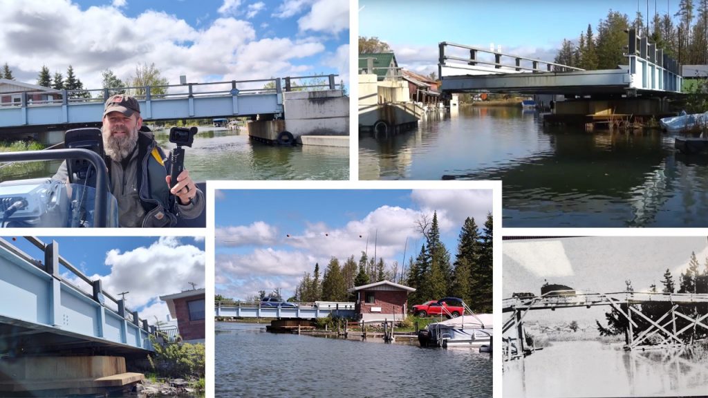
Then, in the 1970’s it had been refurbished.
Even with the name, “High Bridge,” (bottom right) the span still hadn’t been elevated enough to accomodate the steamships. The vessels would have to “hinge back” their smokestacks. The Topinabee had even been equipped with a telescoping smokestack but it’s pilot house was still too tall and needed to be “hinged back.”
As we approached the swing bridge, I was curious if we’d be able to fit under it. Chuck quickly loosened the antenna and turned it parallel to the water. He sat comfortably with his hand on the wheel, while I squished myself onto the bow floor.
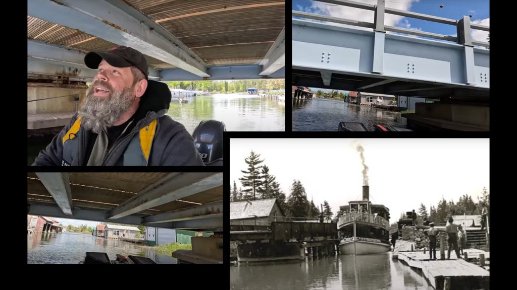
We cleared the underpass smoothly. I sat in awe of how the steamships had once passed through the narrow opening of the swing bridge. (pictured bottom right)
Alanson
Alanson had been settled as a lumber town in 1875. Buzzing with sawmills, Alanson was incorporated in 1905. Today, the charming town of Alanson has 778 residents with their motto being “A place to enjoy. . . A place to remember.”
I will remember Alanson, for sure! Before our trip along the waterway, I had a chance to meet Wayne, a museum curator for the Inland Water Route Historical Museum. Wayne was a wealth of information and he had opened up the museum just for me! The displays and photos are worth the visit.
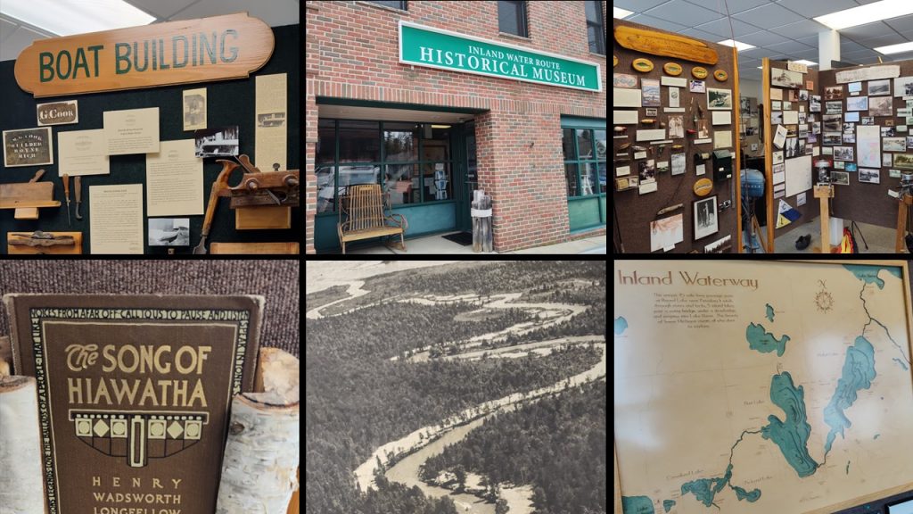
6217 River Street, Alanson, Michigan.
Let’s get back on Crooked River. . .
Devil’s Elbow
Crooked River comes by its name honestly. There are several points where the steamships would have to move forward and backward repeatedly to maneuver around several tight bends.
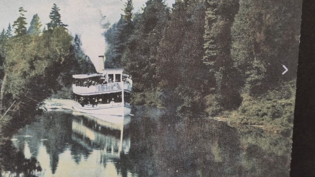
Photo Credit: The Milwaukee Clipper
Devil’s Elbow and Horseshoe Bend also carry their names well. Crew members had even used poles to help guide the vessels around tight river bends.
Crooked River was mesmerizing! With chirping birds and splashing fish we passed quaint cottages at a no-wake pace.
Burt Lake
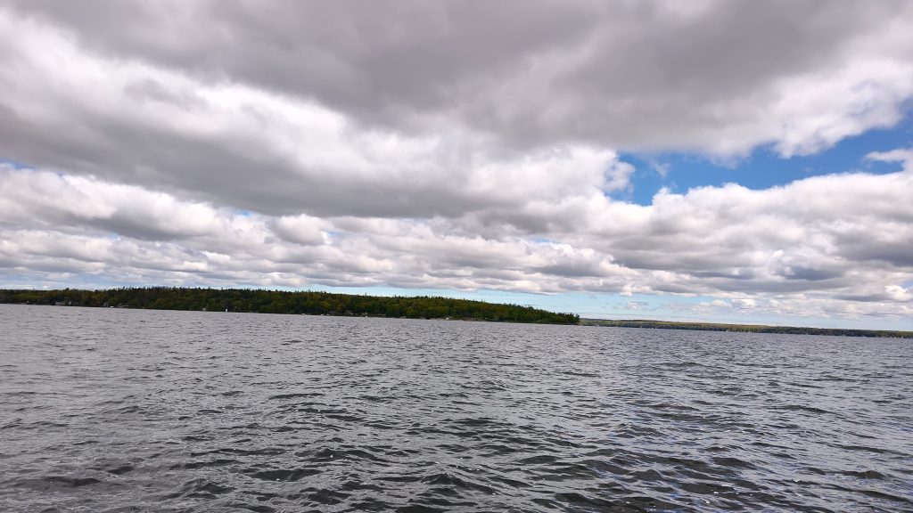
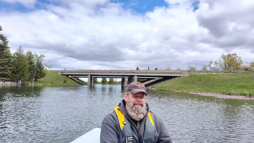
As we reached the estuary, opening into Burt Lake, the wind danced with five miles of water to the north and another five miles to the south. I tightened my hood and pulled on my gloves. We’d be following the western shoreline to the south until we met Indian River at the southeast tip of the lake.
William Austin Burt and John Mullett had surveyed the area from 1840-1843. “Burt Lake” earned its name from the surveyor, William A. Burt. He went on to invent the solar compass. This light weight tool, didn’t receive interference from the metal in the ground, making it revolutionary. This invention brought William Austin Burt to the 1851 World’s Fair in London.
The Burt Lake Burn Out
This peninsula had once been a thriving settlement of Chippewa and Ottawa Natives. Sadly, on October 15, 1900 local law enforcement burnt their village. This became known as the “Burt Lake Burn Out.”
Sheriff Fred Ming and his deputies had placed the villager’s belongings outside and set their homes ablaze. Apparently, a land developer had claimed this land “due to back taxes.” But the land hadn’t been able to be taxed as it had been “in trust” at the Governor’s office.
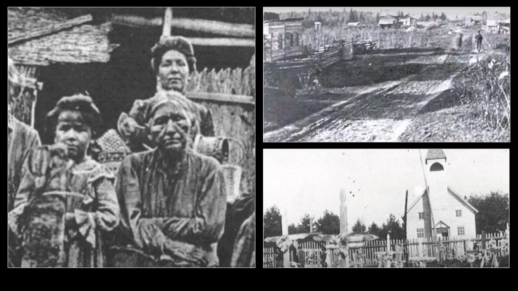
Drawn out court proceedings followed. By then, the residents had relocated. Some as far away as Cross Village.
We continued along the Burt Lake shoreline until we came to the Indian River channel.
Indian River
Indian River meandered, speckled with tidy cottages and friendly waves.
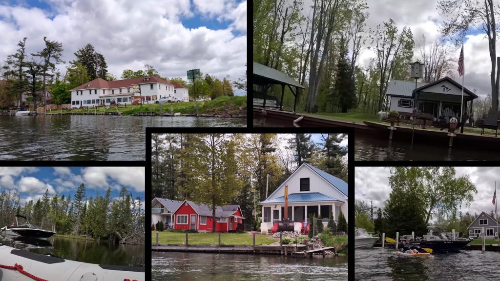
Photo Credits: Chuck Hayden
Many people opt to travel the inland waterway by kayak or paddle board. (bottom right) There’s plenty of room for larger boats as well. (bottom left)
I 75
Indian River turned to wilderness when suddenly we heard automobiles rushing nearby. Interstate 75 passes over Indian River. As you travel along the highway, look to your east, you’ll see “day markers” for the inland waterway boaters. You may be able to spy a boat or two.
The town of Indian River was settled by Floyd Martin in 1876. He’d opened a store with a post office, hoping the railroad would be built through town. Sure enough, the Michigan Central Railroad laid tracks through town a few years later, putting Indian River on the map.
Indian River connects Burt Lake to Mullett Lake, which is known for extensive fishing.
Mullett Lake
Named by surveyor, John Mullett, who had worked alongside William A. Burt from 1840-1843. The route took us the length of Mullett Lake, ten brisk miles heading northeast. My hood kept blowing off, so I secured a headband to cover my ears.
Mullett Lake has earned the 2017 distinction as having the most diverse fish population. There are 39 different species in the water, which reaches a 144 foot depth.
If you enjoy fishing, across the inland waterway seventeen species of fish can be caught! A few popular species are yellow perch, walleye, bluegill, brown trout, northern pike, rainbow trout, steelhead, small mouth bass and large mouth bass.
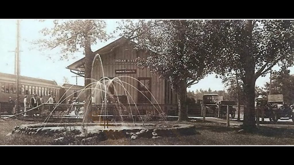
Topinabee
At the northwest corner of Mullett Lake is the town of Topinabee. Started in 1895 with 35 residents, Horace H. Pike capitalized on tourism. He chose the name “Topinabee” from a Potawatami Chief who had been known as a strategic warrior. Horace Pike had opened the Pike Hotel and owned a steamship he had named, Topinabee. Horace Pike even sold “medicinal” water from the nearby Sanitas Spring, which had been used regularly by the railroad for their steam engines. He had bottled this spring water and sold it for a profit.
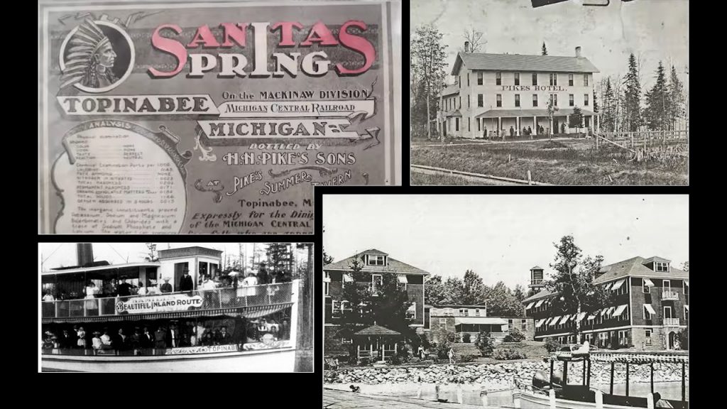
The Topinabee train station had been a hub of activity. The artesian well had brought residents to town daily. The telegraph, located at the train depot, had connected the residents to the vast world beyond. When the train whistle blew, the community clustered around the tracks to greet passengers and receive newspapers from Detroit as well as their own mail.
A field stood next to the train station. Mr. Kennedy, a store owner, had organized baseball games there. A resident during the 1920’s, Beth Chamberlain, had said that adults and kids alike had wanted to be on Mr. Kennedy’s team.
Beth had described how her family often took the early southbound train to Gaylord for doctor appointments and then returned on the 4:00 pm northbound locomotive. Freight trains had stopped in Topinabee four times each day. Two from the north and two from the south.
Today, over 25,000 people call Topinabee home. It’s a bustling city and even busier in the summer season.
After the brisk crossing of Mullett Lake, the Cheboygan River’s warmth was welcoming.
Cheboygan River
“Cheboygan” is an Anishinaabe word meaning “through passage.” This river had been vital along fur trading routes leading to Lake Huron, the Straits and Mackinac Island.
The Cheboygan River was wider and more industrial looking. One of the first things we passed under was an old Detroit-Mackinac Railroad bridge. Now it’s a paved trail for bikers and hikers.
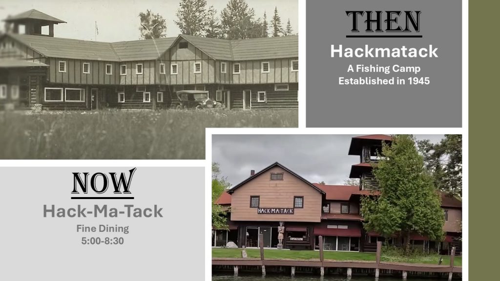
Some cottages popped up along the shoreline with the Hackmatack Restaurant coming into view.
The “swoosh” of my winter-wear seemed to clash with the summer, vacation vibe.
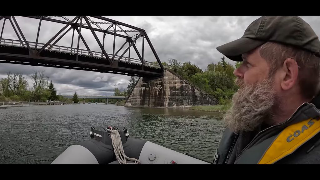
Soon we approached the Cheboygan Lock.
Cheboygan Lock
Originally constructed by a group of Civil War veterans in 1869, the Cheboygan Lock has helped boaters navigate the river. Then in 1927 the lock had been enlarged, making room for ships carrying lumber.
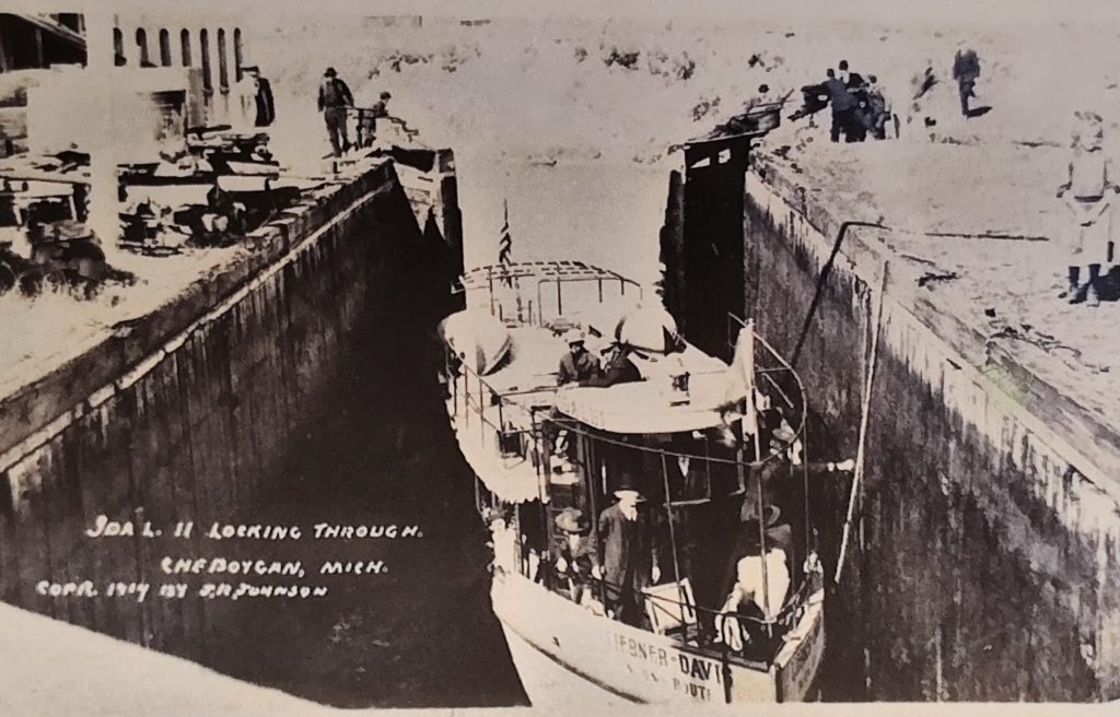
Photo Credit: The Milwaukee Clipper Museum
Newly remodeled, once again, and very recently reopened, we gave it a go.
“Six bucks. Cash Only. No Card. No Apps. Just a handshake with history and a few wet dollars.” Chuck said, “Still ran by the Army Corps of Engineers, the locks are a quiet workhorse that keep the water and stories moving.”
Next, we came to the Cheboygan draw bridge and skywalk.
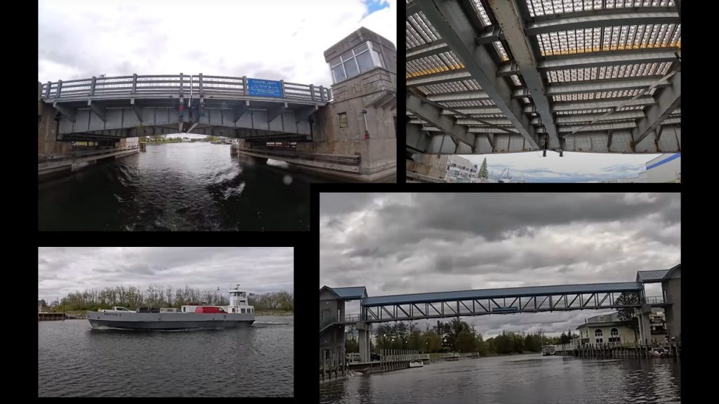
Since 1944, the United States Coast Guard Cutter and Ice Breaker, Mackinaw, had been stationed here in Cheboygan. In 2016 a new vessel replaced the original. (top right)
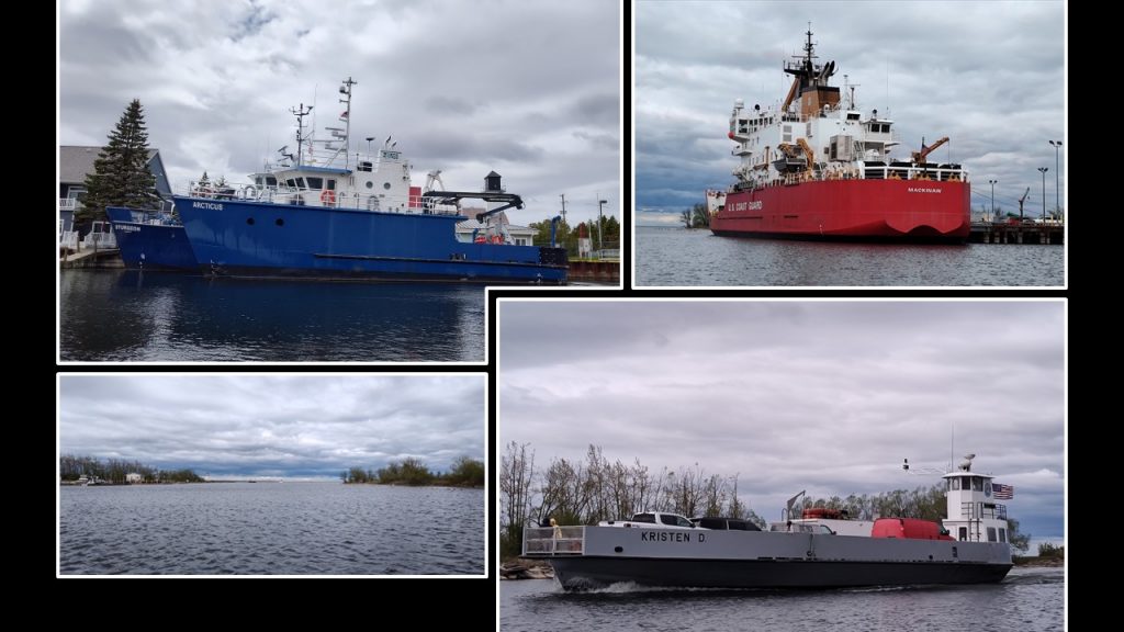
We were thrilled to witness the Bois Blanc Island car ferry (bottom right) coming into port. This was one of six daily crossings. Bois Blanc Island has nearly 70 year-round residents and a two room school. Bois Blanc is located south of Mackinac Island. (Yup, you’re right. You’ve heard of Bois Blanc before. There’s another “Bois Blanc Island” near Detroit.)
The Inland Waterway
What an incredible journey, tracing the whispers from the past 3,000 years, through the inland waterway. I marvel at the strength and tenacity of people who had lived, worked and played with an entirely different paradigm of technology. Personally, I am thankful for the comforts of today.
Thank you for coming along! Stay curious and make memories!
Lock Contact Information
Crooked River Lock – Call the Michigan DNR Field Office in Petoskey at (231) 347-2311
Alanson Swing Bridge – Call the City of Alanson at (231)-548-5431
Cheboygan Lock -Call the Michigan DNR Field Office in Cheboygan at (231) 627-9011
Related Links:
Restless Viking Inland Waterway trip YouTube video
Father and Son, Chuck and Noah’s Inland Waterway trip YouTube video
Resources:
Wayne from The Inland Waterway Museum, Alanson, Michigan
Lumber Camps WITL
Crooked River Lock video Alanson
Indian River Chamber of Commerce website
Burt Lake Burn Out article
Indian River Resort Region Chamber of Commerce website
Department of Natural Resources website
Sunrise Coast US 23 website
Michigan Interactive website with video clips of the Inland Waterway highlights
