Did you know that there were phantom towns published on road maps by a University of Michigan graduate? According to the “Fletcher” 1978 Michigan highway map, the phantom cities of “Goblu” and “Beatosu” stood proudly in northern Ohio. Why were phantom towns added to maps? Join us on a journey of jolliness and joshing. Find out why phantom towns really do have a purpose.
Peter Fletcher
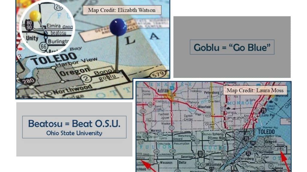
A University of Michigan graduate, Peter Fletcher, had strategically placed “Beatosu” and “Goblu” just over the boarder in Ohio on the 1978 Michigan road map. Fletcher had been the chairman of the Michigan Highway Commission in the mid 1970’s. Years later, Peter Fletcher had shared his story and confession with U of M reporter, “gwkright.”
The Mackinac Bridge Colors
It had all started when a fellow U of M graduate teased Peter Fletcher and inquired, ‘As the chairman of the Michigan Highway Commission, how can you let them paint the Mackinac Bridge green and white?’ He had been referring to their long time rival, Michigan State University, whose colors are green and white.
Peter Fletcher responded with a shake of his head and a shrug of his shoulders, ‘It’s in compliance with the federal highway regulations.’ Honestly, Fletcher had no say in the colors coating the Mackinac Bridge.
But a seed had been planted in Peter Fletcher’s creative mind. What could he control as chairman?
Michigan’s Fletcher Map
In his position, as the chairman of the Michigan’s Highway Commission, Fletcher could control the production of Michigan road maps. Fletcher’s eyes shifted as he narrated his nonsensical mischievousness to the U of M reporter. Fletcher had admitted to hiring a “cartographer to include two fictious towns on the official map.”
With the University of Michigan’s main rival being Ohio State, Fletcher chose his phantom town’s names. “Goblu,” meaning “Go Blue” and “Beatosu,” as “Beat O.S.U.” These phantom towns had been placed in northern Ohio as a gesture of jest.
These maps, printed in 1978, had lifted eyebrows on both sides of the state lines. Fletcher had commented, “We have no legal liability for anything taking place in that intellectual swamp south of Monroe.” Ohio residents were furious!
Rivalry: University of Michigan and Ohio State
These phantom towns on Fletcher’s map had brought a volcanic eruption of emotion from Ohio fans. This decade-long Big Ten rivalry had centered around the football coaches, Bo Schembechler and Woody Hayes.

Coach Woody Hayes pictured top right.
Photo Credits: “Daily Brett” “Roll Bama Roll” “The Columbus Dispatch” “MVictors” “The Spun”
Ohio went right to the top and contacted Michigan’s Governor William Milliken. The maps would have to be reprinted without “Goblu” and “Beatosu.” As for Peter Fletcher, well, he had willingly sacrificed his entire chairman’s annual income of $60,000 as a compensation gesture for the ink and paper needed to reprint the maps.
Do you happen to have a 1978-79 “Fletcher” Michigan Road Map? One in mint condition could be worth up to $55.00 today.
Phantom Towns Vital Purposes
Actually, phantom towns have held significant purposes over decades. Wartime and copyright have been the main reasons for phantom towns.
During WWII the Soviet Union purposely printed maps containing many mistakes in order to confuse the German army. Misleading the enemy resulted in their disorientation which had saved lives.
As far as copyright, cartographers have been known to add phantom towns, nonexistent streets, bends in creeks or change the elevation of mountain peaks. These specifics can help identify their work so if another printer plagiarizes their map, they can easily identify it.
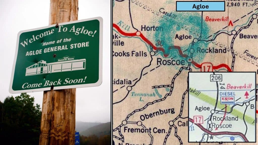
There are phantom towns all around the globe! “Agloe” has been the center of the fictional book, “Paper Towns” by John Green, written in 2008. Later, this book had been made into a movie by the same title, released in 2015.
Phantom Town: Agloe, New York
Otto G. Lindberg and his assistant, Ernest Alpers, had been cartographers at the General Drafting Corporation in New York. They had been one of the “Big Three” map mapmakers in the nation, alongside H.M. Gousha and Rand McNally, from 1930-1970.
As a copyright trap in 1937, Lindberg and Alpers made an anagram of their initials, “Agloe,” and placed the phantom town along two dirt roads, NY206 and Morton Road in the Catskills.
Decades later, in the 1950’s, Rand McNally published a map of New York State with the town of “Agloe” charted on their version. The employees of General Drafting Company hopped out of their seats and issued a copyright claim.
Rand McNally vowed innocence, claiming there was a general store at that corner along with a gas station. In fact, they had received confirmation from the Delaware County records.
Darlene Beers: The Truth
There had been an “Agloe Fishing Lodge” at one point in the late 1930’s. A postcard had documented its existence.
“But there never was a general store.” Darlene Beers stated to the Times Record-Herald reporter in 2016. She had lived at that corner since 1983. Her family had owned the property for two generations. Darlene’s great-grandfather, John Nead, left the land to his son, Frank Nead, Darlene’s grandfather. Frank had sold the property to a group calling themselves, “The Agloe Associates.”
The Nead family believes that “The Agloe Associates” had been a phantom business created by Rand McNally. Darlene believes that Rand McNally had purchased the property and added an “Agloe General Store” sign to the old fishing lodge. “It had been easier than fighting a court case.” Darlene had pressed her lips together as she shook her head.
Agloe Today
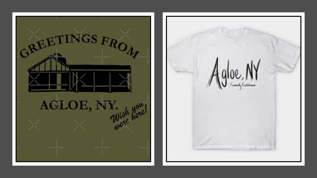
Due to John Green’s book, Paper Towns, and the movie coming out just a decade ago, the Agloe intersection has become a destination and a reason for capitalists to profit.
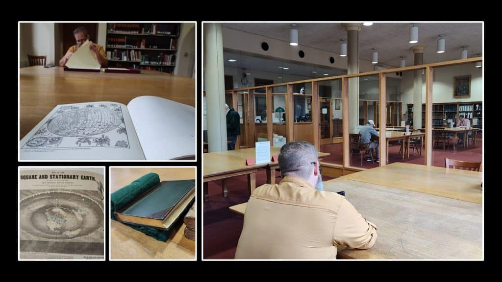
Ponderings At The Newberry Research Library
For centuries maps have shaped our perspective of the world. I can see how a cartographer would want to embellish their work with an artistic mark or phantom town, making it their own. Creating graphic representations of the world can be a daunting task. Perspective plays a huge role in one’s vision of the terra.
Speaking of perspective, check out Africa in relation to the Great Lakes. This postcard isn’t just blowing wind from each corner. . .
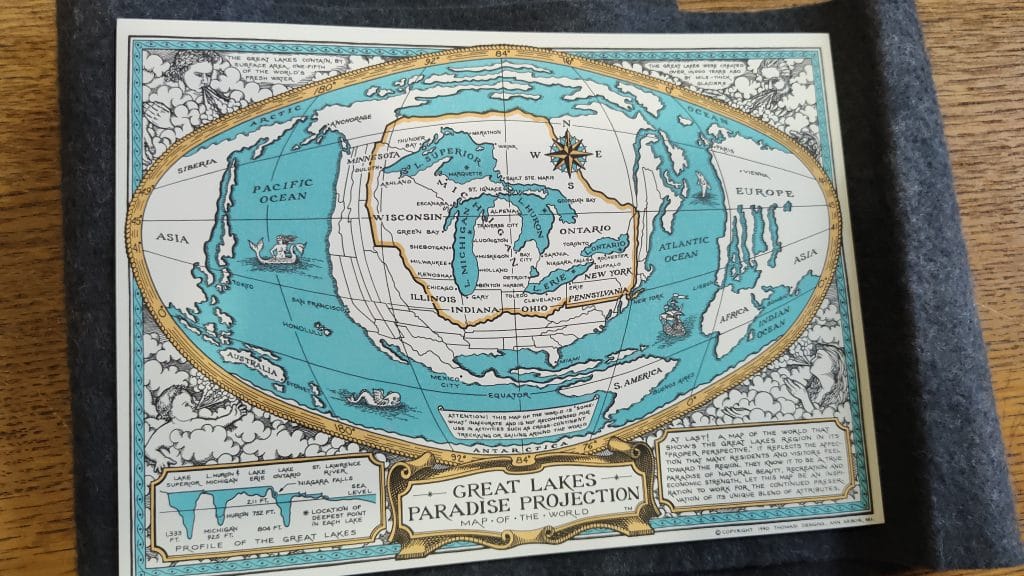
Map Credit: Thomas Designs 1990
While in Chicago we spent time in the map room at the Newberry Research Library. Requesting resources and searching through atlases had started this process of being interested in the cartographer’s art and unique markings.
Thank you for joining us on this journey of phantom towns. As for the rivalry between U of M and OSU, which extends as far back as The Toledo War, continues today as one of the most intense college football clashes in our nation. Stay curious and make memories!
Related Links:
“Paper Towns” Novel by John Green 2008 is available at the Thriftbooks site
Resources:
“History of Cartography” Leo Bagrow -Reviewed and Enlarged by R.A. Skelton, London 1964
“The Phantom Atlas” by Edward Brooke-Hithching 2016 United Kingdom
Times Record Herald – Record on Line article October 30, 2016
“Paper Towns and Other Lies Maps Tell You” article by Treehugger blog by Laura Moss May 2020
University of Michigan “Taking Some Latitude” article by Elizabeth Watson Fall 2016
MLive article by Jonathan Oosting November 2012
MGOBLOG article by gwkright April 2014
Atlas Obsura New York Agloe


